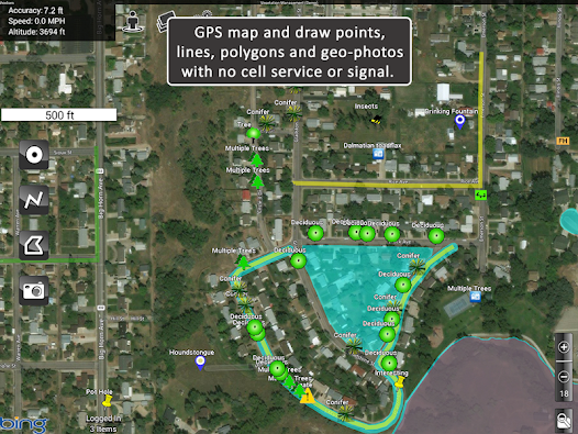
MapItFast transforms your phone or tablet into a powerful field mapping and data collection tool—even when you’re off the grid. Quickly create points, lines, polygons, and geophotos with a single tap with no GIS expertise required.
Key Free Features:
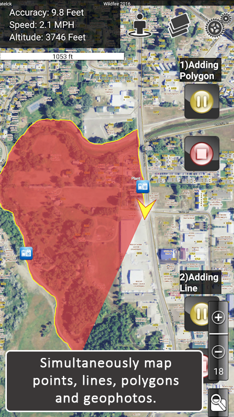
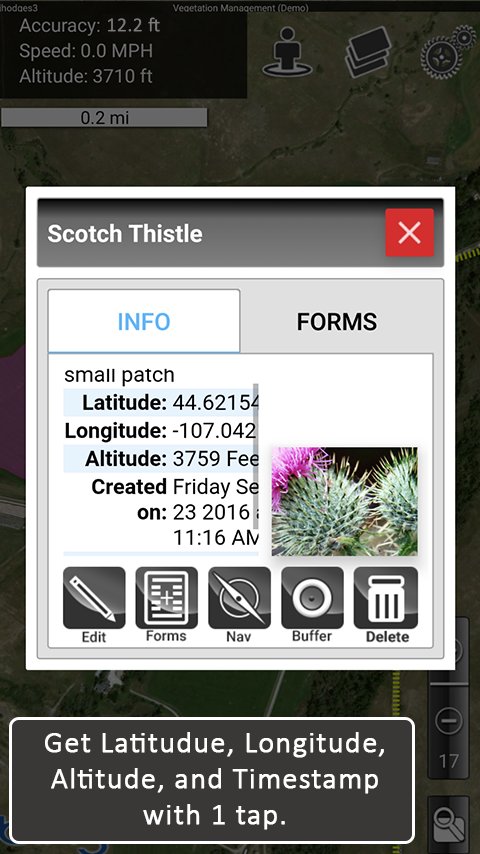
• Tap the icon to map objects instantly via GPS, or long-press to draw them by hand.
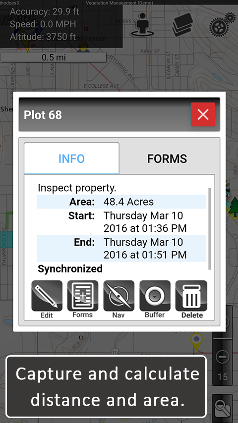
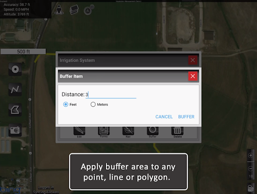
• Capture geophotos, measure distances, and calculate areas in real time.
• Pause or resume GPS tracking at any moment, and work on multiple lines or polygons simultaneously.
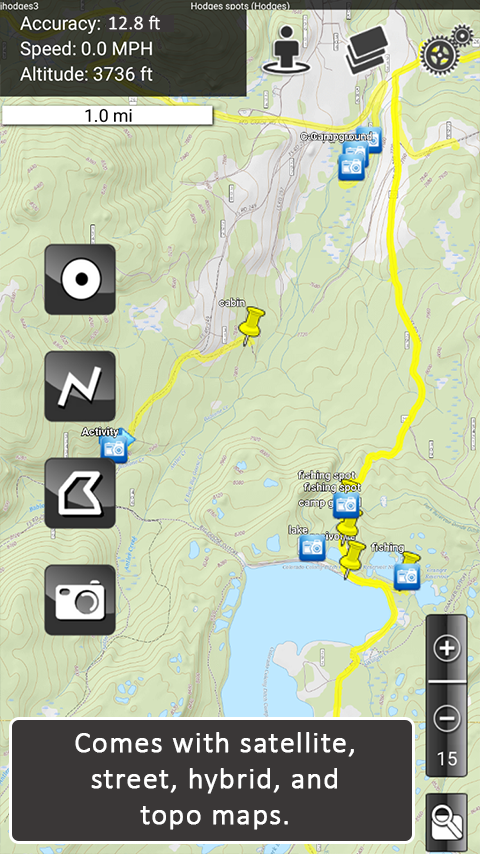
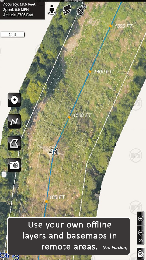
• Choose from aerial, street, and topo basemaps for a clear reference in any environment.
MapItFast Professional
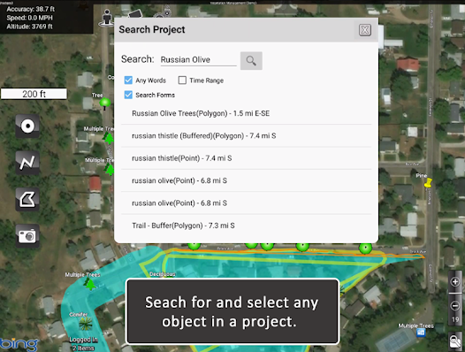
Upgrade to the paid version for enterprise-level functionality and organize your work into projects, add custom basemaps and digital forms, and automatically sync everything to your private cloud account. MapItFast Professional includes web-based mapping features that seamlessly synchronize projects and user data across Android and iOS devices, fostering collaboration on unlimited projects and enabling custom form creation.
Key Paid Features
• Cloud-Based Sync: Access maps and data across devices and on the web.
• Real-Time Collaboration: A web portal shows projects, users, and updates as they happen.
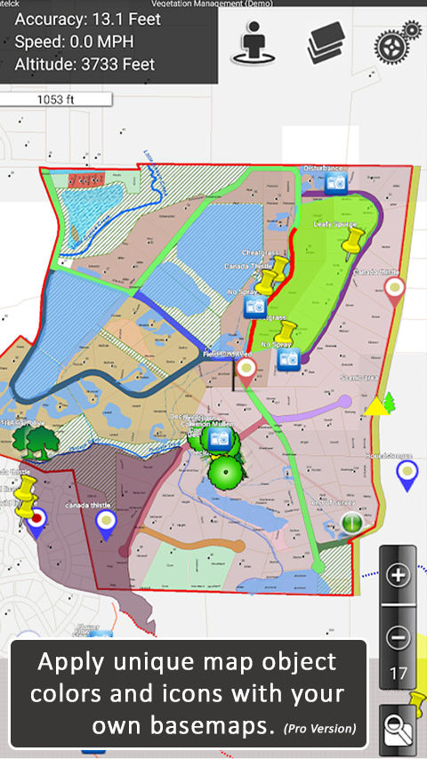
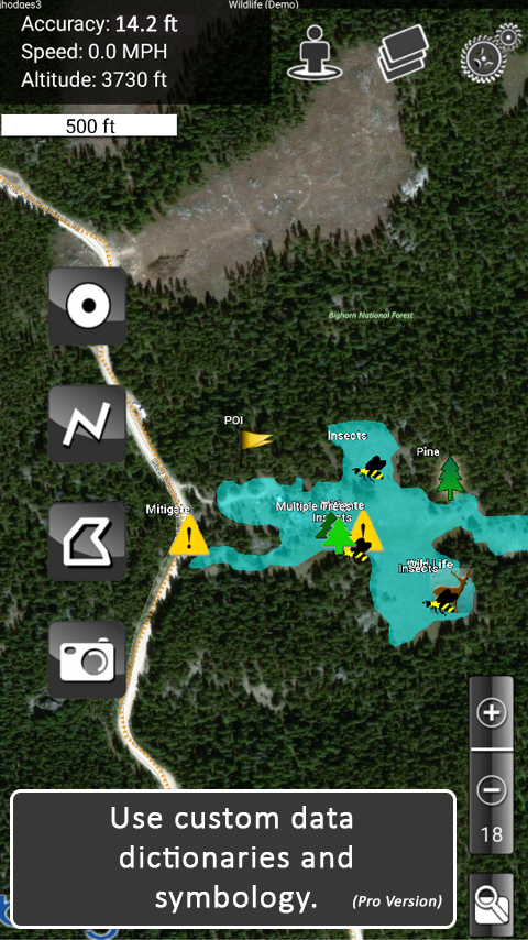
• Custom Maps & Symbology: Easily load and distribute your own mapping styles.
• Integrated Forms: Add attributes directly to map objects in the app.

 +100宝石


 分享
分享